Monday, December 10, 2018

Antarctica discovered contributing to sea-level rise—still!


Dinner in snow kitchen. McMurdo Station, 2010

Sea-level rise (SLR) is a stealthy impact of global warming, showing up unwelcome as storms have hit the coastlines of the globe. There's more to come. 


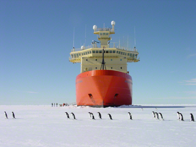
I’ve often blogged on how Antarctica influences sea level rise and the uncertainties about how much (11/5/2017; 1/8/2017).

In a recent letter to the international journal Nature, Slater and Shepherd (1) have drawn attention to new data on ice mass loss from Antarctica detected by satellite measurements over the ten-year period 2007-2017. Converting ice mass to SLR they observed that the rate of Antarctica’s contribution to SLR has increased 40% in the past few years—it’s accelerating. 

They compared the SLR contribution for Antarctica they computed against the projected SLR that the Intergovernmental Panel on Climate Change (IPCC) issued in its last report in 2013 (AR5; 2). What they note is that the SLR they measured follows the AR5 predicted curve for the business-as-usual, worst-case circumstance. This is when no real effort is made by nations to curb greenhouse gas emissions.

The unsettling conclusion is that the worst-case predicted curve computed five years ago is now matched by observations. The AR5 report projects a worst-case 980 millimeters (38 inches) of SLR by the year 2100. Of this Antarctica is on track to contribute 151 millimeters (6 inches). 

Slater and Shepherd note that as little as 10 centimeters (100 millimeters; 4 inches) of storm surge results in floods in many coastal locations. We’ve all seen this on the news. 

Taken in total, over 3 feet of SLR predicted for the world will result in coastal retreat of beaches, cliffs, buildings, towns, and infrastructure. It could be even worse. The prediction curves do not account for catastrophic events like Antarctic ice cliff collapse that I’ve covered in previous blog entries listed above. That could result in doubling SLR to 6 feet by 2100. 

Santa Barbara, my city, is preparing for a century of SLR with the adaptation and mitigation that this will require (When-will-sea-level-rise-swallow-Santa-Barbara?).

1. Antarctic ice losses tracking high; Nature Climate Change, | VOL 8 | DECEMBER 2018 | 1024–1026.

2. Church, J. A. et al. in Climate Change 2013: e Physical Science Basis (eds Stocker, T. F. et al.) Ch. 13 (IPCC, Cambridge Univ. Press, 2013). 

Monday, May 21, 2018

Penguins everywhere! Antarctic populations increasing

Adelie penguins crossing in front of the research icebreaker N.B. Palmer.
  Photo © John Diebold.

To prove that Antarctica still keeps many secrets and is full of surprises, an enormous penguin colony has been discovered by satellite imagery combined with ground and aerial drone surveys. 

Writing in Scientific Reports,Borowicz et al. detected a previously unknown colony of more than 750,000 Adélie penguin-mating pairs on the Danger Islands. That island group is located in a rarely visited area near the tip of the Antarctic Peninsula across from South America. The Danger Islands are on the eastern side of the Antarctic Peninsula. Colonies on the western side have suffered a decrease in population over the past few decades. These decreases have been attributed to climate change. Historical aerial photos of the Danger Islands show that the population there has been stable over the years. The discovery of a robust population on the eastern side of the peninsula minimizes the overall impact of global warming on the population in the peninsula region.

Asking the larger question, how have the numbers of Adélie penguins fared over recent decades, Lynch and LaRuereported another surprising result in 2014. They conducted a census of Adélie populations across all of Antarctica and found a greater than 50% increase in the population of mating pairs since the last estimates in 1993. Part of the increase was due to using improved satellite imagery and other survey methods. They found a total population of almost 3.8 million mating pairs. Borowicz et al. note that the Lynch and LaRue census missed much of the giant colony they found on the Danger Islands, so the number of mating pairs is likely even larger. Looking closer, Lynch and LaRue also found that populations decreased on the western side of the Antarctic Peninsula but that decrease was offset by a substantial increase in mating pairs on East Antarctica. They attribute these patterns to climate change. For one, Adélies depend on krill associated with sea ice. Sea ice has decreased off western Antarctic Peninsula due to warming temperature there but has increased in the Ross Sea and in East Antarctica, thus supporting population growth. I discussed the connections between sea ice and climate change in a blog in 2014. For another reason, climate change has caused coastal ice retreat in many regions around the continent. In East Antarctica, this has created ice-free ground for new colonies to be established and for existing colonies to expand. They propose eleven new colonies in their census. 

Penguins inspecting human, Sulzberger Bay, Marie Byrd Land.
Photo © B. Luyendyk
These studies are good news. Who doesn’t love penguins? I’ve encountered a few, from a legal distance, in my Antarctic visits. One memorable encounter occurred from an icebreaker off Cape Adare where a very large colony was established on a cliff face hundreds of feet tall. The black basalt rock was stained pink – penguin guano, pink from digesting krill, their main food. Even from a mile or so offshore, the stench was overwhelming!


Borowicz, A., McDowall, P., Youngflesh, C., Sayre-McCord, T., Clucas, G., Herman, R., Forrest, S., Rider, M., Schwaller, M., Hart, T. and Jenouvrier, S., 2018. Multi-modal survey of Adélie penguin mega-colonies reveals the Danger Islands as a seabird hotspot. Scientific reports8(1), p.3926.

Lynch, H.J. and LaRue, M.A., 2014. First global census of the Adélie Penguin. The Auk131(4), pp.457-466.

Sunday, March 11, 2018

On the Billboard, MBL, West Antarctica

The Billboard, Sarnoff Mts., Marie Byrd Land.
Photo B. Luyendyk, © Amer. Geophys. Union. 

From a distance, we saw the tall face of the buff-colored granite tower known as The Billboard illuminated by a low Antarctic sun. 

It cast a deep blue shadow on the ice surface behind it and stood out abruptly from the ice plain along with its brother peaks. They marked the last visual evidence of solid ground at the edge of the vast West Antarctic Ice sheet that continued to infinity beyond them to the east. Our helicopter slowly circled the plateau that marked the top of this monolith; we approached for a landing and the helo gently shuddered and sounded its loud clop-clop-clop as the pilot slowed the craft and prepared to land. The plateau was bare of snow except for a small patch he selected to rest on. We settled down with a rocking motion. The jet engine whined as it came to a stop. Suddenly it was silent, as we were. Before us lay a panorama not seen but by only a handful of humans. Certainly, no one had been to the top of this rock before.
         I stepped out and my boots squeaked in the snow. There was no other sound and no wind. The air was clean and sharp in my nostrils. Above us was the sky without a cloud. I left K.L. and Colin behind and cautiously made my way to the cliff at the plateau edge 100 yards distant. Here I saw the drop was vertical and froze; my altimeter showed the plateau was 2300 feet above the ice plain directly below. I stepped back.

         Behind me K.L. was setting up his camera; still, no one had spoken. I could hear my breathing as I took account of the remarkable place where I found myself. I surveyed 360 degrees of the horizon and I found my thoughts blocked and my head swelling with fullness. Nowhere else on Earth can a human experience such isolation and pure beauty. I didn't know what protocol to follow to demonstrate the effect this event was having on me. Far to the north another range appeared, jet black and confusing my eyes against the white snow and ice.

         
Luyendyk on Billboard, January 8, 1993. Photo © Kuno Lecha
The sun's disk was low over the horizon because it was near midnight. Beneath it, the blue-white ice changed to a gold and silver path leading towards me. The sky glowed orange and pink around the sun as I faced it while behind me was a deep indigo. Between me and the horizon, tens of miles away lay an undulating expanse of white and blue. A few scattered hills and peaks interrupted the enormity of the snow surface. I gazed for a few minutes and imagined that the undulations were moving, that the peaks were islands, and that we had found ourselves inside a white ocean.